DSS Staff Spotlight: John Clark Conducts Research on How to Digitally Preserve Geospatial Data

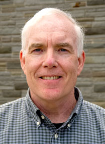
John Clark, Data Visualization & GIS Librarian at Lafayette College Libraries Department of Digital Scholarship Services
When you picture digital collections, image and text files such as those represented in Lafayette College Libraries Digital Collections may come to mind. But what about geospatial data types like shapefiles, raster data, and LiDAR data? Although much exciting digital humanities research relies on geospatial data, digital libraries and repositories have a long way to go to sustainably and comprehensively preserve this data. John Clark, Data Visualization & GIS Librarian at DSS, conducts research about how to digitally preserve historic geospatial data for use and re-use by researchers today and in the future. His article The Long-Term Preservation of Digital Historical Geospatial Data: A Review of Issues and Methods appears in a recent issue of the Journal of Map & Geography Libraries. John writes,

Cover of the Journal of Map & Geography Libraries
“scholars who have often spent years developing Geographic Information Systems for historical analysis have come to the realization that the more information technology evolves, the less likely it is that the historical geospatial data which they have painstakingly created will be accessible for many years to come… While there are currently no permanent solutions to these issues, there are a number of prudent steps that can be taken to preserve such data past the short-term, thus making it more likely that these valuable cultural resources can be migrated in step with advancing technologies well into the future.”
Building on his research published in this article, John attended two recent conferences to share ideas with like-minded practitioners. At the Social Science History Association Conference in Montreal last November, John organized the panel “From Historical GIS to Historical Spatial Data Infrastructures: Lessons Learned and Challenges Ahead.” This discussion featured experts from Michigan Tech University and the Polish Academy of Sciences. In January, he attended Geo4LibCamp at Stanford University. According to its website, the Geo4Lib “unconference” is an opportunity to “share best-practices, solve common problems, and address technical issues with integrating geospatial data into a repository and associated services.” John attended as part of his role consulting for DSS on possibilities for incorporating geospatial data in our Samvera-based digital repository.
John’s expertise in geospatial data management makes him a unique resource for consultation on any research you may undertake involving geospatial data. You can reach him at clarkjh@lafayette.edu or submit a consultation request in the DSS Preliminary Request Form.